The Visual Data Revolution - Waypoints Issue 03 article
Waves Group’s Mark Lawrence and Rob Williams report on how the latest techniques for visual data acquisition are transforming the ways P&I clubs manage claims for greater certainty.
(Digital Services Lead, Waves Group)
(Maritime Civil Engineer, Waves Group)
The recording of high-quality visual data is becoming increasingly important to modern seafaring. It is particularly relevant when assessing marine casualties and for resolving insurance claims and disagreements between parties. Data that enables all parties to visualise the scene and background to the incident, as well as the resulting damage, has become ever more invaluable.
The collection of as much evidence as possible is a key factor for any potential future court case or arbitration process. It is therefore common for leading P&Is like West to engage the services of an independent multidisciplinary marine consultancy, such as Waves Group, to collect this evidence and present the data in meaningful ways to people with a variety of technical backgrounds.
The rapid understanding of the situation establishes the need for someone to attend on site. Waves Group can send skilled and experienced assessors to the scene; a consultant maritime civil engineer, for example, who’s expertise is required to evaluate the damage sustained to any fixed or floating infrastructure and the potential cause.
The difference now is that the attending assessor can utilise a range of new technologies, including a 360 degree camera or mini drone camera, to quickly capture every visual detail of the scene. Using this technology means that the cameras can record all angles simultaneously, including information that the assessor inspected, and other details that they could not have seen.
This extensive visual data can be streamed almost immediately to the P&I club providing a real-time ‘virtual’ overview and immediate clarity of the situation. The visual data can also be stored providing a comprehensive library for future reference or analysis, should the incident develop into a major claim.
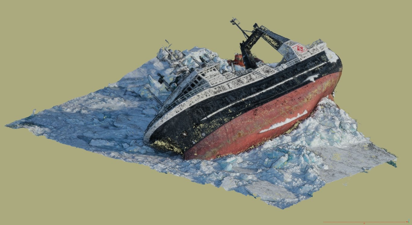
This is a 3D model of the grounded fishing vessel 'Northguider' created using photogrammetry from a drone
This means a virtual and scalable model can be created allowing people, such as lawyers, who might not have a technical engineering background, to ‘walk around’, look inside or through the damaged structure so comparing it with its undamaged state.
Now consider another claim, but further down the line, when the P&I club might need to invite tenders to salvage or repair a vessel, perhaps in a remote location and covering a couple of seasons. Systems were brought in during Covid lockdowns that were found to save both time and money in such scenarios and have hence been retained as best practice.
As part of the traditional procurement process, tendering companies would make significant assumptions or add multiple protective clauses to contracts to account for the ‘unknowns’. Contractors typically add provisional costs to many elements of the tender to cover the ‘worst case scenario’ levels.
Consider also a wreck survey in deep water conducted with sensors mounted on Remotely Operated Vehicles (ROVs). The surveyed damage can be overlaid onto a digital twin of the vessel supplied by the naval architect that designed it. This is a service Waves Group has provided for P&Is like West. It saves on the cost of the claim, because when it’s possible for the salvor to ‘walk’ or ‘fly-through’ the wreck on a computer screen it means that fewer expensive assumptions about the scope of work, to remove or stabilise the wreck, need to be made.
It also means that tenders can be let without flying numerous contractor representatives halfway round the world to personally attend the site, saving both carbon and yet more cost to the claim, that would eventually find its way through to P&I club members.
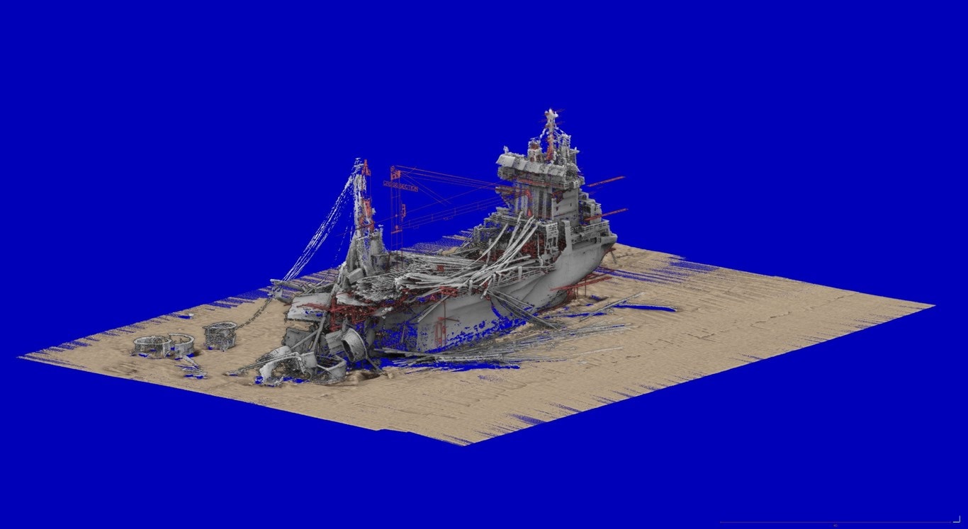
This is a 3D model of the stern section of the wreck of the ‘Thorco Cloud’ which sank following collision in the Singapore Straits, created using multibeam sonar from an ROV
Visual data technology is therefore changing the whole way that P&I clubs work with claims. As a result, the clubs have begun to take much more control of incident data in recent years. The rapid understanding of an incident, and the recording of every visual detail of the scene from all angles is becoming invaluable. It also provides confidence to the clubs that the details of the incident are understood as early as possible, and that that a detailed visual record is on file for future reference.